Dynamic Content Mapping in Elementor: Display Custom Post Types on Interactive Maps

Elementor dynamic content lets you pull real-time information from your WordPress site—like custom post types, user profiles, or ACF fields—and display it anywhere on your pages. When you combine this power with interactive maps, you can showcase locations, events, or listings visually and intuitively, all without juggling API keys or complex coding. It’s a game-changer for anyone managing dynamic, location-based content on WordPress.
Why Standard Map Embeds Leave You Wanting More
You’ve probably tried basic map embeds or even a Google Maps widget in Elementor. It works—until you need to show more than a single static location. Maybe you run a directory of local businesses, or you want to let visitors find events near them. Standard map widgets hit a wall fast: you’re stuck with manual pins, limited styling, and the ever-present headache of managing API keys or billing accounts.
It’s frustrating. You know your content is dynamic—your custom post types are full of rich details and changing data—but the map on your site just sits there, static and lifeless. That’s where dynamic content mapping comes in.
How Dynamic Content Mapping Works in Elementor
Imagine your Elementor site as a living, breathing platform. Dynamic content mapping takes information from your WordPress database—like a list of properties, restaurants, or events—and displays each item on an interactive map. Each pin pulls data from your custom post types, showing details like title, image, or a call-to-action when clicked. No more static maps; every update in your content is reflected instantly on the map.
For example, say you run a community events site. As you add or update events (each with their own location), the map on your homepage updates automatically to show the latest happenings. Visitors can click a pin, see event details, or even filter events by category—without you touching the map widget ever again.
Typical Use Cases: Where Dynamic Mapping Shines
You don’t need to run a travel agency to benefit from dynamic content mapping. Here are some scenarios where it transforms the user experience:
- Real estate listings: Show properties on a map, filter by price, type, or availability.
- Business directories: Display every location with real-time details pulled from custom fields.
- Event calendars: Let users find events near them, sorted by date or category.
- Local guides: Map attractions, restaurants, or amenities with custom icons and tooltips.
- User submissions: Let members submit their own locations, instantly appearing on the map.
If you’ve ever wished your map could keep up with your content, these examples will feel all too familiar.
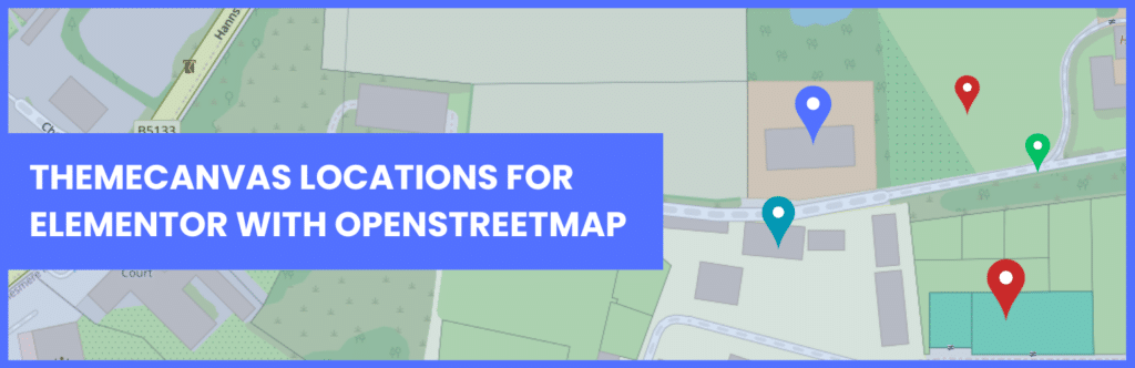
Why OpenStreetMap (and Not Google Maps) Is a Game-Changer
OpenStreetMap (OSM) provides global, open-access mapping without the licensing headaches of Google Maps. With OSM, you avoid the hassle of API keys, usage limits, or surprise bills. That’s especially important for UK-based businesses or anyone concerned about privacy and compliance—OSM lets you integrate interactive maps into Elementor with total freedom.
With plugins like Themecanvas, you get seamless OSM integration inside Elementor, unlocking full control over map styling, layers, and dynamic data—all without the red tape of proprietary platforms.
The Building Blocks: What You Need Before You Start
Before diving into dynamic mapping, make sure you have these pieces in place:
- Elementor (Pro recommended): Enables dynamic content features and advanced widgets.
- A custom post type: For example, ‘Locations’, ‘Events’, or ‘Properties’—created with plugins like CPT UI or ACF.
- Location fields: Latitude and longitude values for each post, stored as custom fields.
- A mapping plugin with dynamic support: Such as Themecanvas, which brings OpenStreetMap functionality into Elementor.
Get these set up, and you’re ready to map your content dynamically—no coding required.
Let’s Build: Mapping Custom Post Types in Elementor (Step-by-Step)
You don’t need to be a developer to make this work. Here’s how to connect your custom post types to an interactive map in Elementor:
- Create your custom post type. Use something like CPT UI to set up ‘Locations’ or ‘Properties’.
- Add custom fields for latitude and longitude. Plugins like Advanced Custom Fields (ACF) make this straightforward.
- Populate your posts. Add real-world data—addresses, coordinates, descriptions, images.
- Install your dynamic mapping plugin. For OpenStreetMap, activate Themecanvas.
- Add the map widget in Elementor. Drag the OSM widget onto your page.
- Set up dynamic queries. Link the widget to your custom post type, mapping lat/lon fields.
- Customize pin content. Use dynamic tags to pull in post titles, images, or custom fields for each marker.
- Style and filter. Adjust map appearance, enable clustering, or add filters for categories or tags.
With these steps, your map will update automatically as you add or change posts—no manual pin management ever again.
Real-World Example: A Local Business Directory That Updates Itself
Let’s say you’re building a directory for independent coffee shops in Manchester. You’ve created a custom post type (‘Coffee Shops’) and added fields for name, description, and coordinates. Every time you add a new shop, it’s instantly pinned on your map—no copy-pasting coordinates or updating maps by hand.
Even better, you can let users filter by features (like Wi-Fi or dog-friendly), and clicking a pin shows a pop-up with images, reviews, and a direct link to the shop’s page. The map becomes more than decoration—it’s the front door to your content.
Advanced Filtering: Letting Users Find Exactly What They Need
A static map treats every location the same, but dynamic maps can help users zero in on what matters to them. Here’s how you can empower visitors to filter map results:
- Category filters: Allow users to toggle categories (e.g., ‘Vegan’, ‘Open Late’, ‘Wheelchair Accessible’).
- Date/availability filters: For event maps, show only what’s happening this week.
- Custom field filters: Maybe you want to highlight locations with special offers or amenities.
These filtering options are often built into advanced mapping plugins for Elementor, and with dynamic content, they always reflect your latest data.
The Anatomy of a Dynamic Map Pin: More Than Just a Marker
A truly dynamic map pin can do far more than mark a spot. Each pin pulls in data from your posts—think featured images, star ratings, or ‘Book Now’ buttons. When a user clicks a pin, you can display a mini profile or even launch a dedicated Elementor popup for deeper engagement.
Imagine a property listing where each pin expands to show a photo gallery, price, and direct contact form—all without leaving the map. That’s the kind of seamless experience users remember.
Balancing Performance and Flexibility: What to Watch For
Dynamic maps are powerful, but they can be resource-intensive—especially if you’re displaying hundreds of locations. Here’s how to keep your site fast and responsive:
- Clustering: Group nearby pins to reduce clutter and speed up rendering.
- Lazy loading: Only load map data as users scroll or zoom.
- Efficient queries: Use Elementor’s dynamic query controls to limit the number of posts shown.
- Optimize images: Ensure images in popups or marker previews are compressed.
Most mapping plugins offer these features out of the box, but always test your map’s speed on both desktop and mobile.
Elementor Dynamic Content: Tips for Power Users
If you’ve already built custom post types and used Elementor’s dynamic tags, you’re ready to level up. Here are a few expert moves:
- ACF Relationship fields: Show related locations on a single post map (e.g., ‘Nearby Events’).
- Dynamic popups: Trigger Elementor popups with full post details when a map marker is clicked.
- Conditional display: Only show certain pins based on user roles, geolocation, or custom conditions.
- Template overrides: Design custom info windows or popups with Elementor templates.
These techniques let you create truly interactive, personalised maps that go beyond what standard widgets can do.
Troubleshooting: When Dynamic Maps Don’t Work as Expected
Even the best setups can hiccup. Here’s what often trips up Elementor dynamic content mapping—and what you can do about it:
- Missing coordinates: If a post lacks latitude/longitude, it won’t display—use validation or fallback defaults.
- Caching issues: Dynamic maps may not update instantly with aggressive caching—clear cache after updates.
- Plugin conflicts: Some mapping plugins don’t play nice with others; test with only essentials enabled.
- Permissions: Custom post types or fields may be hidden due to role restrictions—double-check visibility.
If you’re stuck, walk through each step methodically. Most problems have a simple fix once you know where to look.
Frequently Asked Questions
Q: Can I use Elementor’s free version for dynamic content mapping?
A: Elementor’s free version allows basic layout control, but dynamic content features (like dynamic tags) and advanced integration require Elementor Pro or a compatible add-on.
Q: Do I need coding skills to set up dynamic content maps?
A: No coding is necessary. Most modern mapping plugins, including Themecanvas, offer point-and-click interfaces for connecting custom post types and custom fields.
Q: How do I prevent API key or billing issues with my maps?
A: By using OpenStreetMap-based solutions (like Themecanvas), you avoid API keys and the billing traps of platforms like Google Maps. Setup is straightforward and privacy-friendly.
Q: Can I display multiple custom post types on the same map?
A: Yes, advanced plugins allow you to pull data from multiple sources, assign different marker styles, and even filter by post type or taxonomy.
Q: What’s the best way to handle hundreds of map pins without slowing down my site?
A: Use clustering, lazy loading, and efficient content queries. Optimized plugins will offer these features, ensuring maps load quickly even with large datasets.
Q: Can users submit new pins to the map from the frontend?
A: Absolutely. With the right setup (using forms and custom post types), users can add new locations, which will appear dynamically on your map once approved.
Your Dynamic Mapping Checklist: Get Set Up with Confidence
Before you dive in, keep this checklist handy to ensure a smooth dynamic mapping project:
- Have you set up your custom post type with latitude/longitude fields?
- Is your Elementor install (Pro recommended) up to date?
- Have you chosen an OpenStreetMap-based mapping plugin (like Themecanvas)?
- Are your posts populated with all required data?
- Can you filter and display maps using dynamic queries?
- Have you tested for performance on desktop and mobile?
- Did you validate user submissions (if enabled) and test permissions?
Follow these steps, and you’ll avoid the most common roadblocks—bringing your dynamic content vision to life in Elementor, with maps that are as smart and flexible as your data.