Building a Multi-Location Map for Small Business: Complete Setup Guide

If you want to display multiple business locations on your WordPress website, you don’t need to wrestle with Google Maps’ API keys or complicated code. With the right WordPress plugins—especially those that integrate OpenStreetMap with Elementor—setting up an interactive, multi-location map is straightforward and cost-free. Here’s exactly how you can map all your locations, highlight your services, and give customers a seamless way to find you.
Why Multi-Location Maps Matter for Small Business Websites
You’ve probably felt the frustration of trying to explain to a customer where your different branches are—or worse, lost a potential client because your website only showed your main office. These days, customers expect to find every location at a glance, on an interactive map, ready to click for directions. A multi-location map solves this instantly, reducing confusion and making your business look modern and accessible.
For small businesses with more than one location, this isn’t just a nice-to-have. It’s a basic customer service tool. You can highlight different services at each branch, help users find the nearest spot, and even showcase unique features (like wheelchair access or parking). An interactive map can become a central part of your brand’s online presence.
Why WordPress Plugins Are the Secret Sauce (And When You Need More)
If you’ve spent hours searching for ways to display multiple locations, you know there’s no shortage of mapping solutions out there. But not all are created equal.
WordPress plugins are popular for a reason—they let you add powerful features to your site without hiring a developer or touching code. The best plugins handle everything from data entry to map display, right inside your WordPress dashboard.
But here’s the catch: most plugins rely on Google Maps, which means jumping through API hoops, dealing with usage limits, and sometimes paying hidden costs. That’s where alternatives like OpenStreetMap come in, offering free, flexible mapping without the headaches.
What Makes a Great Multi-Location Map Plugin? (A Real-World Checklist)
Choosing a map plugin isn’t just about pretty pins. Here’s what actually matters when you’re mapping real business locations:
- No API keys required: Avoid Google’s complicated (and sometimes costly) API setup.
- Elementor integration: Build maps visually, right in your page editor.
- Custom post type support: Map locations, events, or any custom data you manage.
- Bulk location import: Upload dozens or hundreds of sites in one go.
- Customizable markers and popups: Match your branding and highlight important info.
- Responsive design: Looks great on mobile, tablet, and desktop.
- OpenStreetMap support: Free, privacy-friendly, and ready out of the box.
If a plugin can’t handle these, you’ll likely hit a wall just when your business is growing.
The Google Maps Dilemma: Why Many Businesses Are Switching
Let’s be honest—Google Maps is powerful, but it’s not always the best fit for small businesses. You might have tried to set it up, only to get stuck at the API key step, or worried about unexpected billing after a viral post sends traffic your way.
Google’s terms and usage limits can be confusing. For UK businesses that value privacy and predictability, OpenStreetMap offers a compelling alternative. It’s community-driven, open-source, and doesn’t require a credit card. Plus, you’re not locked into a single platform if your needs change.
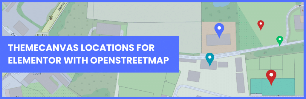
Meet Themecanvas: Effortless OpenStreetMap for Elementor
Here’s where things get interesting. Themecanvas is a WordPress plugin designed specifically for businesses that want interactive OpenStreetMap integration, tightly woven into Elementor. That means:
- No Google API keys or billing headaches
- Drag-and-drop map building in Elementor
- Add locations as posts, products, or custom types
- Fully customizable map styles, markers, and popups
If you’ve ever wished for a map builder that “just works” and feels like a natural part of your website, this is it.
How to Plan Your Multi-Location Map Before You Touch a Plugin
Jumping straight into plugin installation is tempting, but a little planning saves hours of rework. Here’s how experienced site owners tackle it:
- List your locations: Gather addresses, titles, and any unique info (like opening hours or special services).
- Decide what to display: Do you want photos? Contact info? Directions links?
- Group or categorize: If you have different location types (e.g., branches vs. partners), note that upfront.
- Prepare your data: A simple spreadsheet (CSV) makes bulk imports painless.
- Sketch your ideal map: Think about how you want users to interact—filter by area? Click for details? Start with a rough idea.
A clear plan means fewer surprises and a better user experience.
Step-by-Step: Setting Up a Multi-Location Map with Elementor and OpenStreetMap
Let’s walk through a real setup, using Themecanvas as our example. These steps are similar for most modern OpenStreetMap plugins:
- Install and activate your map plugin: Search for Themecanvas in your Plugins screen or upload the ZIP file.
- Add your locations: Create a new post type for locations, or use an existing one (like “Stores”). Add each branch, address, and relevant info.
- Configure your map widget: In Elementor, drag the Themecanvas map widget onto your page. Choose your data source (like custom post type).
- Customize map appearance: Adjust colors, marker icons, and popup content to match your branding.
- Bulk import (optional): If you have many locations, use the plugin’s CSV importer to save time.
- Preview and test: Make sure each location appears as expected and test on mobile devices.
This process puts you in control without touching code.
Real-World Example: A UK Retailer’s Multi-Location Map Journey
Let’s look at how a fictional business—let’s call them BritCraft Gifts—used the above approach to modernize their site.
BritCraft had six shops across England and Scotland. Their old site listed each address in a table, but customers complained it was hard to find the nearest one. After switching to an OpenStreetMap plugin with Elementor integration, they:
- Imported all locations from a spreadsheet
- Added category filters for “Gift Shop” vs. “Workshop”
- Customized marker icons to match their branding
- Embedded the interactive map on their “Find a Store” page
Within weeks, customer feedback improved, and fewer people called for directions. Their staff spent less time on the phone, and online bookings went up.
Comparison Table: Top WordPress Plugins for Multi-Location Maps
This table helps you quickly spot which plugins fit your needs, especially if Elementor integration or OpenStreetMap is a must.
How to Map Custom Post Types (And Why It’s a Game Changer)
If your business tracks more than just locations—think events, staff, or services—custom post types are your secret weapon. With the right plugin, you can:
- Map events by date and location
- Show team members on a regional map
- Highlight service areas or delivery zones
This flexibility is especially useful for agencies or franchises. Instead of being stuck with “just” store locations, you can map anything you manage in WordPress. Plugins like Themecanvas let you choose which post type to map, so you’re not boxed in as your business evolves.
Troubleshooting Common Issues (And How to Fix Them Fast)
Even with the best plugin, things can go sideways. Here’s what trips up most users—and how to get back on track:
- Map not showing? Double-check your plugin settings and make sure your data source (like a custom post type) is selected.
- Locations not appearing? Ensure addresses are in the correct format and geocoded properly. Some plugins let you manually set map coordinates if automatic lookup fails.
- Map looks broken on mobile? Tweak your widget’s responsive settings in Elementor. Sometimes a simple width adjustment does the trick.
- Bulk import fails? Check your CSV for formatting errors (like extra commas or missing fields).
If you hit a brick wall, plugin support forums are often a goldmine of solutions.
The Privacy Factor: Why OpenStreetMap Appeals to UK Businesses
UK businesses are uniquely sensitive to data privacy—especially after GDPR. OpenStreetMap, being open-source and not tied to a big tech company, is naturally more privacy-friendly. There’s no automatic tracking, no hidden analytics, and no risk of customer data being handed to advertisers.
If your customers care about privacy (and many do), using an OpenStreetMap-based plugin can become part of your brand story. You’re not just mapping locations—you’re showing you value their trust.
Making Your Map Stand Out: Tips for a Memorable User Experience
A map should do more than just show dots on a page. To create a truly useful (and memorable) experience:
- Use custom markers: Reflect your brand’s style or location type.
- Interactive popups: Add photos, contact info, or booking links directly in the popup.
- Filter and search: Let users find the nearest branch or filter by service.
- Mobile-first design: Make sure your map is easy to use on a phone—test zoom and tap targets.
- Accessible features: Include alt text and clear labels for users with disabilities.
A little extra effort here can boost engagement and turn your map into a feature customers talk about.
Frequently Asked Questions
Q: What’s the easiest way to add a multi-location map to my WordPress site?
A: Using a WordPress plugin with OpenStreetMap support and Elementor integration makes it simple to add and manage multiple locations without coding or Google API keys.
Q: Do I need to pay for map usage or API calls?
A: With OpenStreetMap-based plugins like Themecanvas, you avoid Google’s usage fees and API limits, making it free for most small business needs.
Q: Can I bulk import my locations from a spreadsheet?
A: Yes, many plugins support CSV import, letting you add dozens or hundreds of locations in minutes instead of entering each one by hand.
Q: How do I map custom post types like events or staff?
A: Choose a plugin that allows you to link map markers to any post type, not just standard “Pages” or “Posts.” This gives you flexibility for unique business needs.
Q: Will my map work on mobile devices?
A: Most modern plugins are mobile-responsive, but always preview your map on different devices and adjust the settings to ensure a smooth experience.
Q: What if I need a custom feature, like filtering by service?
A: Look for plugins with filtering options or flexible data sources, so you can offer users advanced ways to interact with your locations.
Your Next Steps: A Quick-Reference Checklist for Success
Before you install anything, make sure you’re set up for mapping success:
- List all your locations and what makes each unique
- Decide what info and features your map should display
- Choose a plugin that fits your needs—especially for Elementor and OpenStreetMap
- Prepare your data in a spreadsheet for easy import
- Take the time to customize your map’s look and interactivity
- Preview on desktop and mobile to catch any issues early
With a bit of foresight and the right tools, you’ll have a map that’s not just functional, but a real asset to your business.